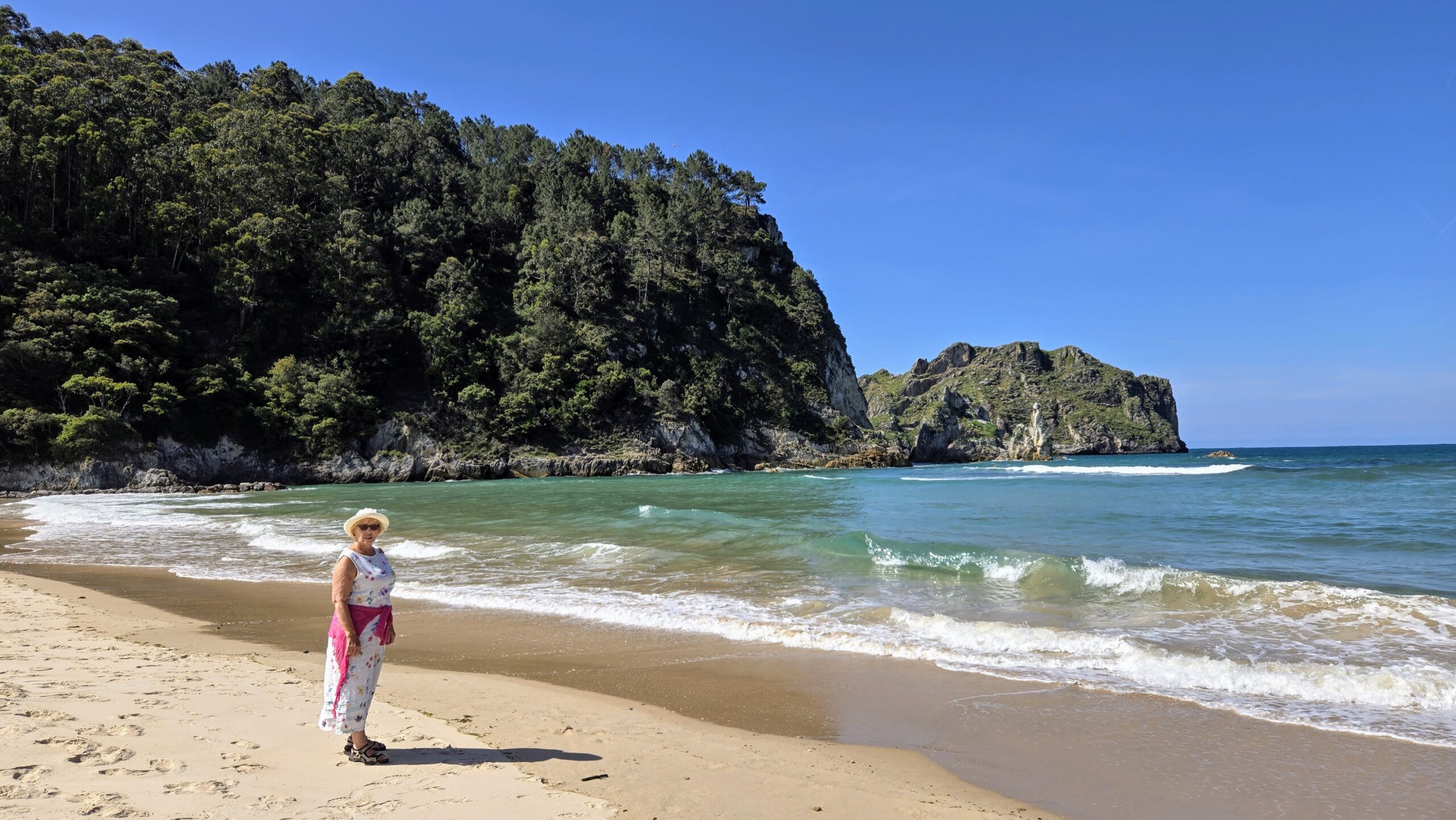
So, it’s time to leave Brantôme. We are heading a bit further north to the other side of Poitiers, just short of Parthenay, to a place called Chalandray. All reviews of the Camping du Bois de St. Hilaire say it’s a nice peaceful site with a swimming pool – an essential feature in these temperatures! We were planning just to stay one night, so we didn’t choose our pitch very carefully.
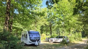
(In the end we stayed a second night in order to explore the area a bit.) At least we had easy access to the sanitaires!
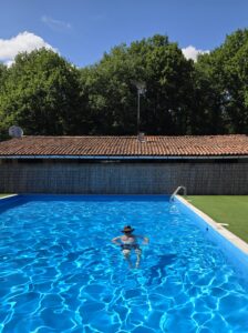
Swimming pool – tick.
Peaceful – well all those reviewers had never visited at harvest time! There’s a factory, Groupe COC Agricultural Cooperative, a few hundred metres away. They process grain for animal feed and to produce bio-fuels. Now, there are literally hundreds of thousands of fields of wheat and barley hereabouts. With the warm, sunny weather there’s a LOT of harvesting going on. Everybody’s at it. I bet there isn’t a single combine harvester standing idle within 100 km of Chalandray! Grain is arriving at the processing plant from first thing in the morning to late in the evening. It’s coming in by massive trucks and huge trailers hauled by tractors. There is a little railway line nearby, but I haven’t seen any sign of rail delivery of the grain, but we can hear the trains!
Our day of exploration took in thousands of hectares of wheat – much of it in various stages of harvesting. We found the little (and largely deserted) villages of Thénesay, Gourgé and Pressigne scattered amongst the golden, yellow, swaying crops interconnected by hundreds of tiny country roads. At many of the intersections, who had right of way was “unclear” at best. But no one would argue with the convoies exceptionnels agriculturals, although, to be fair, we didn’t meet any of them on this occasion. They were all off-road doing their thing. Starting the process of getting tonnes of fodder heading towards our campsite!
Time for some civilisation. Saint-Loup-Lamairé was a rather more animated place a bit further north. There were heaps of people at a couple of bars. Drinking coffees and pressions in the shade of old, pollarded plane trees in the square by the church, l’Eglise Notre-Dame de l’Assomption.
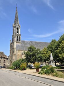
There was also a bus-load of youngsters trying desperately to NOT complete a treasure hunt in town. Collections of non-hunters were strewn about in a shady corners and in the church, while a lone enthusiast quizzed us on the age of the buildings in the Grand Rue Théophane Venard. We found the street on the map. I suggested she walk down there and have a good look at any dates engraved over doors. But that’s a couple of hundred metres walk. She elected not to bother! All my French language efforts wasted!

Glenda found a patch of her favourite flowers behind the church. We also got fleeting glimpses of the Chateau as we left town.
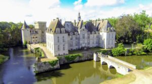
(Clearly not my photo.) The present Château, constructed 1609 – 1626 was built with a footprint in the shape of an H in the honor of King Henry the IV. I knew you needed to know that!
Moving a few kms north we found the interestingly named town of Airvault. Sounds like the HQ of a company offering cloud-based storage for more of our useless back-ups! Actually it’s another town with a grandiose medieval centre. I know we are travelling out of season, but it’s July in less than a week’s time. Parking in these towns is ridiculously easy. The main problem is deciding which space has more shade! Obviously there’s a church, Saint-Pierre d’Airvault.
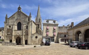
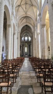
A massive edifice for a town of about 3,300 inhabitants – way less than half the population of our home village. And we are endowed with just a small, inconspicuous Congregational Evangelical Church (with seating for 50 souls?) and a tiny chapel which is much smaller than the pub opposite. (It’s also much less well frequented than the pub!)
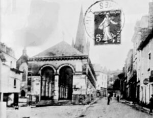
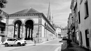
Almost adjacent to the church we found “Les Halles” …

Built at the end of the Middle Ages, they took on their current appearance in 1846. The Halles testify to the importance of the grain trade in medieval times. The structure is 40 metres long and 10 metres wide. It continues its trading history, hosting a weekly market on Saturday mornings, while the grain trading has moved to Chalandray, next door to our campsite. This impressive historical site is also home to a peculiar creature with a white hat!
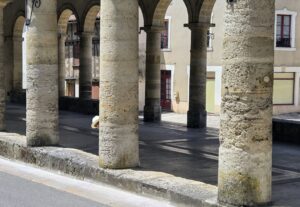
I tried to match the photo (taken in 1846, soon after it’s restoration) on an old postcard but couldn’t quite get the angle right. Need more time – and possibly a step ladder!
In keeping with all French villages and towns, the local loo is well signposted.

I hope not at the same time!
We ended the day in Parthenay. But by then the heat was getting to us. Not only that, but we were a day early! All the clothes shops had notices in their windows. “Fermé exceptionellement so we can change the price labels. Sales start tomorrow morning. Désolé.”
That had taken a lot of organising!
We are moving on – but wait. Someone said something about a navigational error. For some reason, best known to person in the right hand seat, the sat nav had not been programmed with our destination when leaving our pine forest. Well, it is pretty easy. Four kms to the roundabout outside Brantôme (“don’t go through the town whatever you do!”) then head north. We knew the road because we had used it the previous evening to re-fuel. Straight on till you get to Angoulême. An hour later, arriving on the outskirts of Nontron, Limoges was signed straight ahead. But we aren’t going to Limoges. Far too far to the East! Emergency, high-level, managerial discussions debated our options. It transpired that outside Brantôme (at the 4 km marker!) I should have taken the other road going north. An easy mistake to make, but I did vaguely wonder why Angoulême was never once signposted on our road which gradually steered us off to the east.
Options:
1. Go back to Brantôme and start again,
2. Go on to Limoges then turn sharp left, or
3. Take the D75 cross-country to Angoulême.
While Glenda was agonizing with a choice between option 1 and 2, I did a 27 point turn amongst a lot of bemused and in one case, annoyed, Frenchies. As soon as we turned round, Angoulême was signposted to the right. On the D75! I turned right with Glenda still concerned about the caravan-suitability of the departmental road. The pantechnicons coming the other way suggested we should be OK – always provided we managed to avoid hitting one of them!
One slight bonus in all of this was that we found a delightful place for lunch with parking for at least 20 caravans. L’Orée du Périgord on the outskirts of Marthan. It looked REALLY good and set up for maybe 200 diners. Sadly for us, it was only coffee time. So we had our two allongés and got back on the hunt for Angoulême.
So all was not lost, although we were a little misplaced for a while. But you already know we found ourselves again! The navigating officer is now hyper-alert at any and all ronds-points!